Our capabilities come from our team’s experience and background.
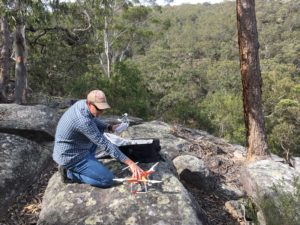
For years we have been involved in expeditions into remote areas of Australia and other parts of the world, gathering data for a variety of projects and purposes. Exploration, mining and land management is our niche, gathering and presenting practical data that is useful to your needs. What we can do for you is:
- Gather data and images (information)
- From Remote places (location)
- Manipulate ours and other data to your needs (customization)
- Deliver this data in any form you require (presentation)
UAV imagery provides a fast, precise and detailed tool for projects involving land management.